CASTLE CRAGS STATE PARK, CALIFORNIA
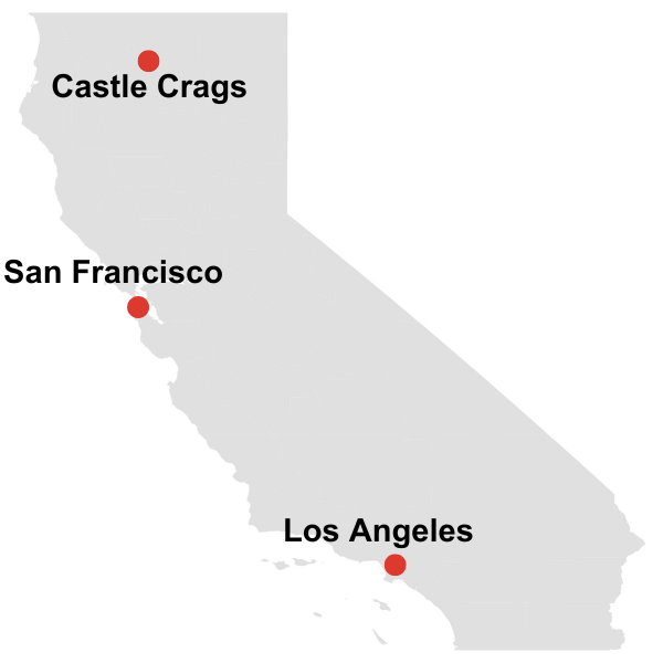
Where: Northern California (closest city: Mount Shasta)
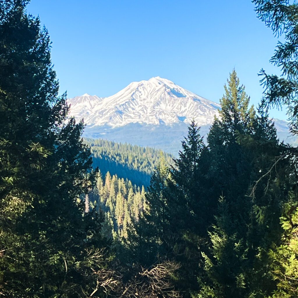
Why Go: See granite spires and domes, waterfalls, and views of Mt. Shasta
Hike Stats: 5.2 mi and 2,066 ft elevation gain to Castle Dome. A range of easier and harder hikes is available as well
How Long to Visit: 1 – 2 days
When to Go: Spring through fall is the best time to visit, but the park is open year round
What to Bring: Downloaded trail maps, hiking equipment, picnic lunch/snacks
Castle Crags State Park, located in Northern California near Mt. Shasta, is a haven for outdoor enthusiasts. The park is a prime spot for hiking, climbing, and camping.
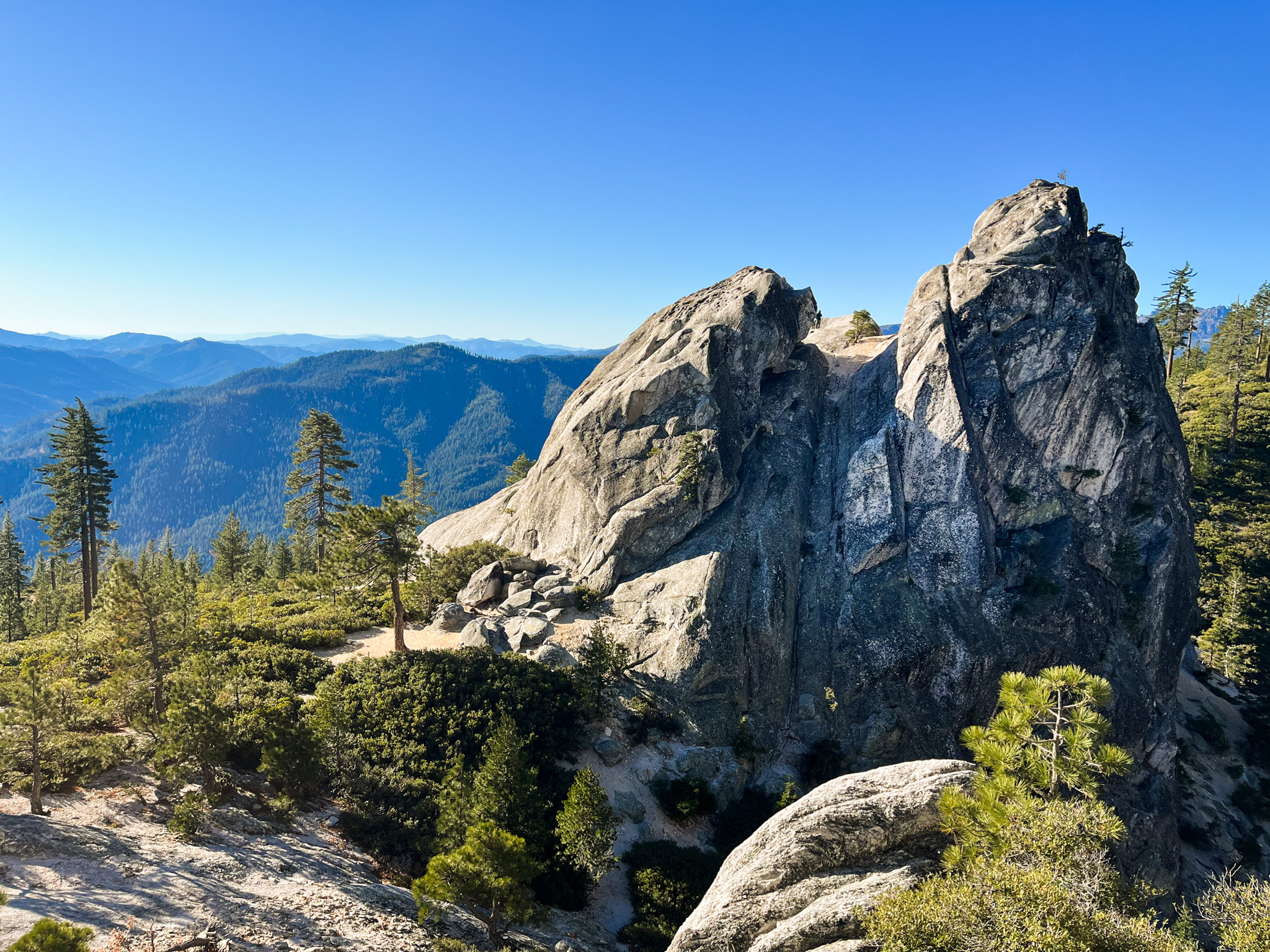
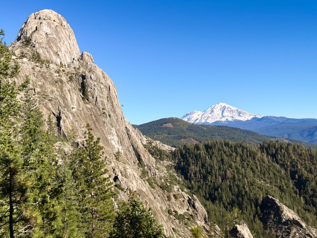
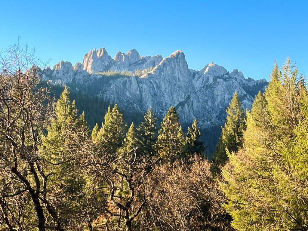
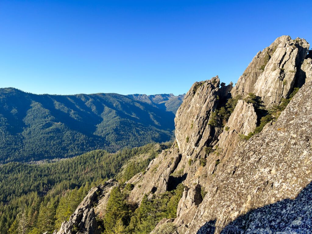
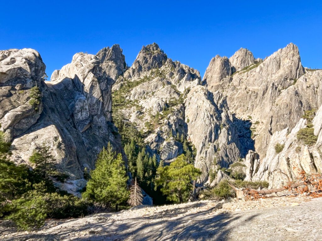
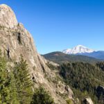
Castle Crags gets its name from a rugged granite rock formation that abruptly emerges from the sea of dense surrounding forest. Towering over 6,500 ft, these formations include spires, domes, and pinnacles sculpted over time by glaciers. The park’s trails lead you to the Castle Crags, scenic waterfalls, and vantage points with breathtaking views of Mt. Shasta.
In this guide to Castle Crags State Park I’ll share how to make the most of your time in the park, as well as a trail guide for hiking to Castle Dome. To help with your itinerary planning, I’ll also suggest nearby attractions and hikes in the Mt. Shasta area.
If you need a refresher, check out my guide to day hiking. For more places to explore in California, browse my California destination guides.
History of Castle Crags State Park
Indigenous people originally inhabited the area that is Castle Crags State Park, relying heavily on fishing for sustenance. In the 1820s white explorers and fur trappers arrived. Unfortunately they brought with them diseases like malaria, which wiped out much of the native population.
The 1850s brought a wave of miners seeking fortunes in rumored gold. The debris from their activity obstructed waterways, disrupting the annual salmon harvest of the indigenous people. Facing starvation, the Indians resorted to stealing flour, which led to the Battle of Castle Crags in 1855. The area eventually proved to be devoid of gold and the miners left, replaced by other mineral and lumber industries.
In 1933 the area was declared a state park. Today Castle Crags is recognized for its ecological and historical significance.
Castle Crags Map and Trail Information
The Castle Crags trails vary from short walks to long hikes. Hiking is a great way to explore the park’s stunning viewpoints, and most of the trails are well-maintained and easy to follow. I’ve listed my recommendations below.
Vista Point Overlook (0.3 mi)
The Vista Point loop is a 0.3 mile, mostly flat walk. It leads to a viewpoint overlooking the Castle Crags and Mt. Shasta; this is a great spot to take some Castle Crags photos. There’s even a telescope installed so you can get a closer look. The trail starts at the Castle Dome Trail parking lot.
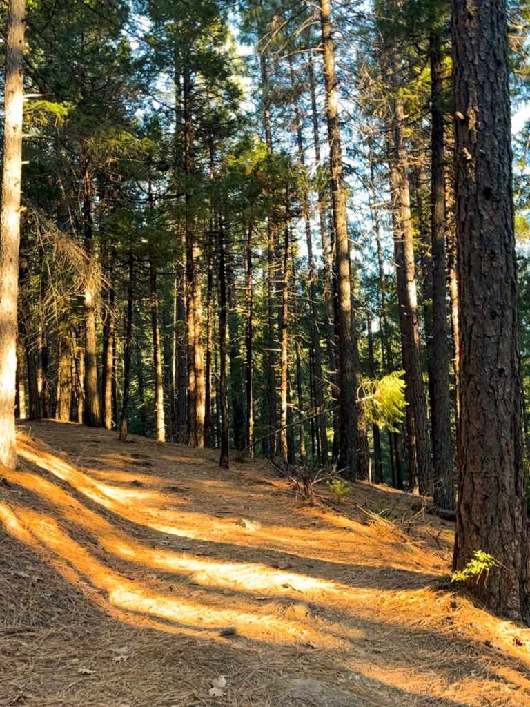
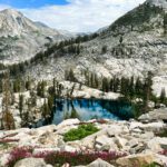
Castle Dome Hike (5.2 mi)
Castle Dome Trail Map
The Castle Dome trail is moderately difficult, at 5.2 miles with 2,066 ft elevation gain. This trail is one of the most popular in the park and ascends to the base of the Castle Dome. From there, you’ll have unobstructed views of Mt. Shasta and a close-up look at the Castle Crags.
The trail starts at the Castle Dome Trailhead parking lot. If this parking lot is full, you’ll have to leave your car at the park’s main entrance and from there take Bob’s Hat trail up to Castle Dome. This hike will be slightly longer, at 7.2 miles and 2,700 ft elevation gain.
The first section of the Castle Dome hike is shaded and moderately inclined. If it’s not too late in the season and water is still flowing, pay a visit to Indian Creek. The 0.2 mile side trail to Indian Creek is located about 1.6 miles into the Castle Dome trail.
The last mile of the Castle Dome hike is steep, rocky, and exposed. The trail ends at the base of the Dome and right next to the Castle Crags. If you look closely, you may spot some climbers on the Crags! You can explore a little further by scrambling, but do not attempt climbing up the Dome without proper climbing equipment and training.
If you’d like to experience Castle Crags camping at its finest, the area at the base of the Dome has many suitable campsites for backpackers. Be aware that there are no water sources up there. Wilderness camping does not require a permit. No overnight parking is allowed at Castle Dome Trailhead, so if you want to camp overnight you’ll have to park at the main entrance and hike up Bob’s Hat trail.
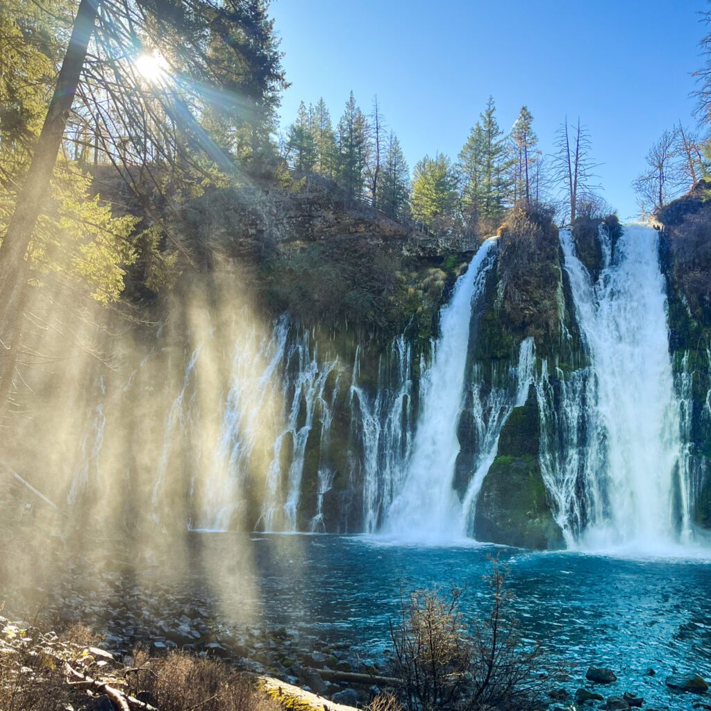
Burstarse Falls (4.9 mi)
Castle Crags State Park is also home to beautiful waterfalls. The trail to Burstarse Falls is 4.9 miles and 1,200 ft elevation gain. This hike starts at Dog Trailhead. The waterfall is stunning but may be dry later in the season, so go in spring or early summer. This trail, unlike the others in the park, allows dogs.
Root Creek Trail (3.1 mi)
To visit another waterfall in the park, take the Root Creek trail (3.1 miles and 479 ft elevation gain). The hike starts from the Castle Dome Trail parking lot and follows the creek, taking you to a small waterfall. The falls may dry up later in the season, so go in spring or early summer.
Useful Tips for Castle Crags State Park
- Limited phone service. Expect limited to no phone service in Castle Crags State Park. Download Google Maps of the area and hiking trail GPS information in advance.
- Beat the heat. Start hiking early in the morning in summer. Many sections of the trails are not shaded and can get hot.
- Check trail conditions. The upper sections of the trails may be covered in ice and snow from late fall to early spring. Check recent trail reviews on AllTrails or call the local ranger station for information on current conditions.
- Leave no trace. Let’s do our part to preserve this beautiful park!
How Long to Stay at Castle Crags State Park
You can visit the park in a few hours, but you’ll need 1 – 2 days if you want to thoroughly explore multiple longer hiking trails.
In 1 hour, you can drive through the park and walk to the Vista Point Overlook. With 2 hours, you can hike a shorter trail, such as the Root Creek Trail. If you have 3 – 5 hours, you can hike one of the longer trails (Castle Dome, Burstarse Falls).
Castle Crags Weather and When to Go
Castle Crags State Park is open year-round.
The weather in the summer is very hot during the day and cool at night, and winters are frigid. If you’re visiting in fall, check local conditions beforehand because fall wildfires are common in the California mountains. I visited in late November; the days were sunny and the trails ice-free.
If you’d like to visit in winter, make sure you have appropriate clothing and footwear. The trails may be covered in ice and snow, requiring traction and snowshoes. In winter, the road up to the parking lot at the Castle Dome Trailhead may be closed, meaning you’ll have to start at the park entrance and take Bob’s Hat trail if you want to hike to Castle Dome. You may need chains to drive through this area in winter.
Castle Crags State Park Information
The entrance fee for Castle Crags State Park is $8. You’ll pay with the ranger at the entry kiosk or at self service machines in the parking lot (in the off season). You can pay with card or cash; bring exact change if using cash with the self service machines. Your local library might have California State Parks passes that you can borrow for free.
There are no specific opening hours for the park. Dogs are allowed in the parking lots and campgrounds. Dogs are not allowed on the trails, with the exception of Dog Trailhead leading to Burstarse Falls.
Castle Crags State Park Directions and Parking
Castle Crags is located along I-5 in Northern California. The closest cities are Dunsmuir (10 min) and Mount Shasta (15 min). The area is a 4 hr 20 min drive from the Bay Area.
Roads within the park are paved. Be careful of oncoming traffic during the last mile up to Castle Dome Trailhead; the road is steep and narrow. Trailers and RVs are not allowed on this section of the road.
Navigating to “Castle Crags State Park” in Castella, CA will take you to the park entrance. You’ll need to drive 10 minutes further to get to “Castle Dome Trailhead”, the parking lot where most trails start. This lot is small and popular, so arrive early to ensure a spot. The parking lots have restrooms.

What to Bring
For a full list of what to bring, refer to my complete day hiking checklist. For this hike I would stress the following:
- Trail Map. Download the map for offline navigation.
- Day Hiking Backpack. Invest in a high-quality and durable pack that will last for years!
- Hiking Shoes. Women’s, Men’s. I do not recommend running or general athletic shoes for this hike. Their lack of traction will cause you to slip.
- Hiking Socks. Women’s, Men’s. Wool is essential to keep your feet dry and blister-free.
- Hiking Pants. Women’s, Men’s. I love these pants because they are lightweight, durable, and have pockets.
- Hiking T-Shirt. Women’s, Men’s. Quick-drying T-Shirts are ideal. Tank tops will cause your skin to rub uncomfortably against your backpack straps.
- Lightweight Long-Sleeve Shirt. Women’s, Men’s. This is the best way to protect yourself from the sun and mosquitos.
- Trekking Poles. These will save your knees on descents and provide stability when crossing streams and rocky terrain.
- Hat. This hike is very exposed, so protect yourself from the sun.
- Sunscreen.
- Lip Balm with SPF.
- Mosquito spray.
- Electrolytes. These help prevent dehydration and fatigue, especially on strenuous hikes in hot weather.
- Water in a Reservoir or Bottle.
- Microspikes. You may need these if you’re going early or late in the season.
- Picnic, snacks. There is no food for sale inside the park.

Where to Stay
Castle Crags State Park Campground
Castle Crags has a large campsite that is open year-round. It’s actually a great home base for a Mt. Shasta camping trip, since there is a lack of campgrounds closer to Shasta.
In the high season, you can reserve campsites 6 months in advance In the low season it is first-come-first-serve. The campground is spacious and has hot water showers.
The park’s smaller Riverside campground is open seasonally and has 12 first-come-first-serve sites.
Accommodation Nearby
Budget: Cold Creek Inn
Mid-range: Mount Shasta Ranch Bed and Breakfast, Mount Shasta Resort, Strawberry Valley Inn, Inn At Mount Shasta, Mossbrae Hotel
Castle Crags Things to Do Nearby
Castle Crags Map of Nearby Attractions
There’s plenty of things to do near Castle Crags State Park. I’ve listed some of my favorites below, along with their driving times. If you’d like some itinerary suggestions, check out my guide to the Mt Shasta area.
- Hedge Creek Falls (10 min)
- Mossbrae Falls (10 min)
- Mount Shasta city & Sacramento River headwaters (15 min)
- Lake Siskiyou (20 min)
- McCloud Falls (30 min)
- Ney Springs and Faery Falls (30 min)
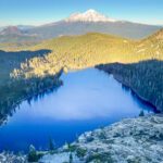
- Castle Lake and Heart Lake (35 min)
- Mt. Shasta Bunny Flat trailhead (35 min)
- Lake Shasta Caverns (35 min)
- Pluto’s Cave (50 min)
- Burney Falls (1 hr)
- Lassen National Park (1 hr 30 min)
- Crater Lake National Park, Oregon (2 hr 20 min)
Thanks for reading, and I hope this guide to Castle Crags State Park was helpful! Which Castle Crags hike are you most excited about? Let me know your thoughts and questions in the comments, I’d love to hear from you.
For more places to explore in California, browse my California destination guides.
Confirm all logistical and safety information before your trip. Also If you buy through links on this site, I may earn an affiliate commission. Thanks for supporting me in creating free content for you to enjoy!
Save this post for later and share on Pinterest!
HIKING TRIP RESOURCES
Head to my Travel Resources Page for more recommendations.
Hiking Checklist and Backpacking Checklist. Make sure you have everything you need before heading out.
Viator and Get Your Guide. If you don’t want to hike or camp alone, there are various organized tours you can join, ranging from day trips to multi-day excursions.
Booking.com. This is my go-to platform for booking accommodation since it consistently gives me competitive prices and additional discounts based on usage.
LifeStraw. This easy-to-use water filter guarantees that you always have access to clean drinking water.
Travel Credit Card. Earn substantial points for travel-related expenses and a very generous bonus when opening an account.
Related Posts
Comments

Hi, I’m Kristina! I’m a solo female traveler sharing my personal experiences around the world. Authentic travel is important to me; in my destination guides I emphasize not just the most spectacular sights but also the local stories and history.
Other things I’m passionate about are discovering hidden gems, budget-friendly travel, and hiking and backpacking. My goal is to show you how to seek adventurous experiences for yourself!
Leave a Comment